Category:Sjûkelân, Franeker
Jump to navigation
Jump to search
| Object location | | View all coordinates using: OpenStreetMap |
|---|
 | |||||
| Upload media | |||||
| Instance of | |||||
|---|---|---|---|---|---|
| Location | Franeker, Waadhoeke, Friesland, Netherlands | ||||
| Heritage designation |
| ||||
 | |||||
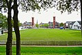
Nederlands: Het Sjûkelân is een kaatsveld in Franeker, waar sinds 1856 jaarlijks de PC wordt gespeeld. Tot 1727 stond op het terrein het Sjaerdemaslot.
|
This is a category about rijksmonument number 15820
|
| Address |
|
Subcategories
This category has the following 2 subcategories, out of 2 total.
P
S
- Sjaerdemaslot, Franeker (2 F)
Media in category "Sjûkelân, Franeker"
The following 25 files are in this category, out of 25 total.
-
 2011-07 Franeker Sternse Slotland 15820 01.jpg 2,112 × 2,816; 2.36 MB
-
 2011-07 Franeker Sternse Slotland 15820 02.jpg 2,112 × 2,816; 3.13 MB
-
 2011-07 Franeker Sternse Slotland 15820 03.jpg 2,816 × 2,112; 2.53 MB
-
 20191007 kaatsbaan Sjukelan Franeker.jpg 5,184 × 3,456; 4.47 MB
-
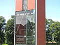
 20191007 Monument voor de Permanente Commissie door Rein Hofstra Franeker.jpg 3,456 × 5,184; 2.53 MB
-
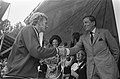
 Beatrix en Claus in Franeker bij kaatswedstrijden, Beatrix (kop), Bestanddeelnr 926-5854.jpg 2,437 × 3,688; 1.36 MB
-

-
-

-

-

-
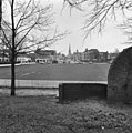
 Bolwerktribune Franeker.jpg 792 × 439; 139 KB
-
 Bunspartij16052005.jpg 1,690 × 1,018; 816 KB
-
 Franeker, PC monument.jpg 2,032 × 1,524; 536 KB
-
 Het mekka van de Kaatssport in Friesland..JPG 4,752 × 3,168; 3.99 MB
-
 It Sjûkelân, Frjentsjer.jpg 2,157 × 1,618; 1.23 MB
-
Jaarlijkse landskaatswedstrijden Weeknummer, 24-14 - Open Beelden - 29242.ogv 58 s, 384 × 288; 11.45 MB
-
 Kaatsen Franeker.JPG 1,600 × 1,200; 916 KB
-
Kaatsfestijn Weeknummer 53-32 - Open Beelden - 30851.ogv 1 min 6 s, 384 × 288; 12.16 MB
-
 PC kaatsen Franeker 02.JPG 2,971 × 1,980; 785 KB
-
 Sternse Slotland - Franeker - 20073837 - RCE.jpg 1,195 × 1,200; 315 KB
-
 Ter herinnering aan W.Westra.jpg 1,428 × 1,920; 635 KB
-
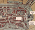 Uitsnede plattegrond Franeker.png 792 × 693; 1.54 MB
-
 Voorstraat - Franeker - 20073808 - RCE.jpg 1,192 × 1,200; 410 KB
-
 Voorstraat - Franeker - 20073809 - RCE.jpg 1,200 × 1,200; 279 KB


,_Bestanddeelnr_926-5854.jpg)


